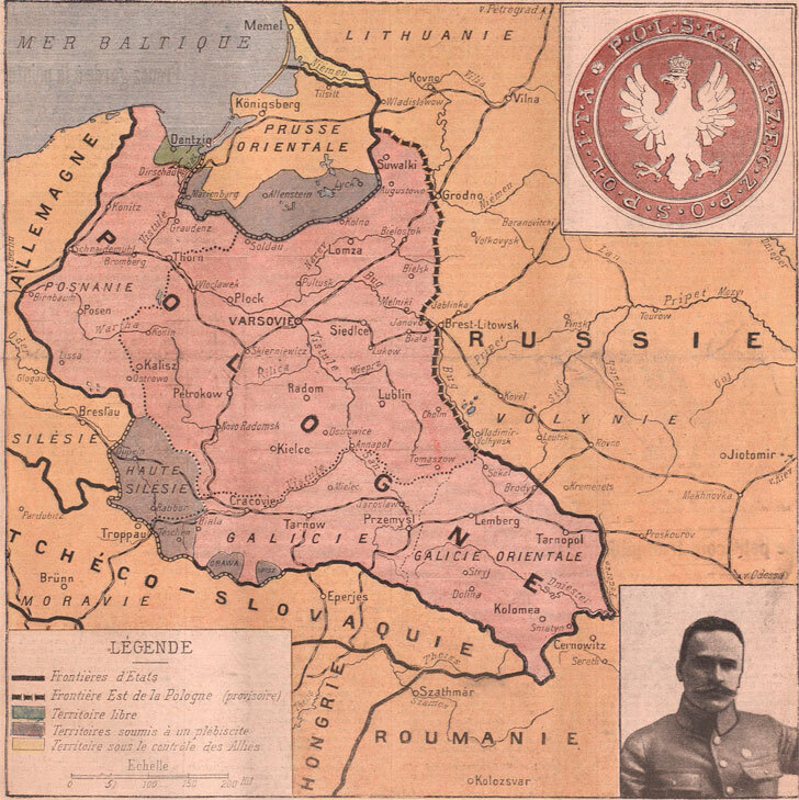
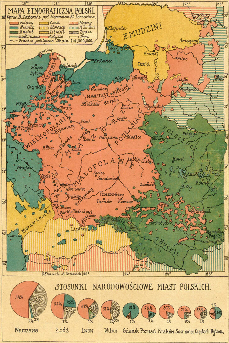
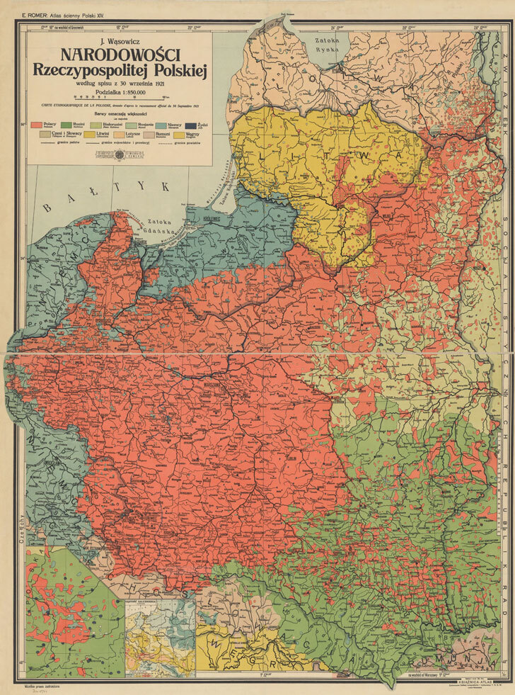
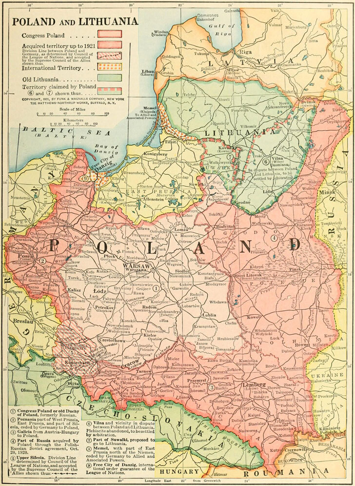
Source: Leon Wasilewski, Die Ostprovinzen des alten Polenreichs: Lithauen und Weissruthenien - die Landschaft Chełm - Ostgalizien - die Ukraina, Krakow, Central Publishing Bureau of the Polish Supreme National Committee,1916.
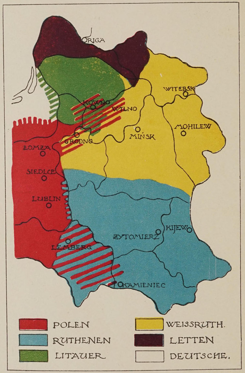
Context and nature of the work
Published in 1916 in Krakow by the Central Publishing Bureau of the Polish Supreme National Committee, Leon Wasilewski's Die Ostprovinzen des alten Polenreichs (The eastern provinces of the former Kingdom of Poland) carried its subject in its very subtitle: Lithauen und Weissruthenien - die Landschaft Chełm - Ostgalizien - die Ukraina (Lithuania and White Ruthenia, the Chełm region, Eastern Galicia, and Ukraine). It was a text illustrated with several black-and-white maps, later reissued in facsimile a number of times, with four cartographic illustrations included in certain later editions.
Wasilewski, one of Józef Piłsudski's closest collaborators, had already specialized before the war in the study of the ethnocultural relations of the eastern areas of the former Polish-Lithuanian Commonwealth, publishing in 1915 in Vienna a companion work, Die nationalen und kulturellen Verhältnisse im sogenannten Westrussland (The national and cultural conditions in so-called Western Russia). He went on to specialize in linguistics, particularly Slavic languages, and ethnography, before becoming Foreign Minister after Poland's reconstitution and one of the principal architects of Poland's policy toward Eastern Europe.
An ethnographic reading of the borderlands
The very title of the work, the "eastern provinces of the former Kingdom of Poland," referred to a vanished political space: that of the Polish-Lithuanian Commonwealth before the partitions. But Wasilewski's purpose was not to restore the historical borders of 1772; rather, it was to examine, province by province, the actual ethnic and confessional composition of these territories as they stood at the turn of the twentieth century. His book thus offered a differentiated account of four major zones:
a) Lithuania and White Ruthenia (Byelorussia), where Lithuanian-, Byelorussian-, and Polish-speaking populations overlapped (the latter often a minority but dominant in the towns and among the landed gentry), alongside a substantial urban Jewish population;
b) The Chełm region, a zone of contact between Polish and Ruthenian (Ukrainian) elements, whose administrative status had recently been upended by the creation in 1912 of the Chełm Governorate, detached by the Russian authorities from the Kingdom of Poland precisely to emphasize its "Russian" and Orthodox character;
c) Eastern Galicia, where the rural population was predominantly Ruthenian (Ukrainian) while the towns, Lwow in particular, were predominantly Polish and Jewish;
d) Ukraine in the broader sense, treated as a distinct national area then in the process of political emergence amid the war.
An ethnographic map of this kind typically relied on the principle of "point" cartography or on urban/rural colour blocks, a method then common in the ethnic cartography of Central Europe (found also among Czech, Ukrainian, or Lithuanian authors of the same period): its purpose was to show that the administrative map inherited from partition does not correspond to the ethnic map, and that Polish settlement, far from being continuous, was concentrated in towns and certain rural pockets, leaving vast stretches of countryside to Lithuanian, Byelorussian, or Ruthenian majorities.
The political stakes: two rival visions of a reconstituted Poland
This is where the work's significance exceeded mere ethnographic scholarship. In the midst of the First World War, as the reconstitution of a Polish state became a major diplomatic issue (the Act of 5 November 1916 issued by the Central Powers, followed by Allied declarations), two major Polish territorial projects were in competition:
1) The incorporationist conception, championed by Roman Dmowski and the National Democrats, favoured the idea of incorporation, envisaging the direct annexation to Poland of the disputed territories, even if this meant gradually Polonizing their populations. This line, which became known as the "Dmowski Line," favoured an ethnically compact, homogeneous Polish state, giving up the most mixed borderlands (Lithuania proper, deep Byelorussia, eastern Ukraine) while intending to fully integrate Eastern Galicia and the Chełm region.
2) The federalist conception, advocated by Piłsudski and his circle, including Wasilewski, envisaged instead a reconstruction of the eastern space on the model of a federation or union of independent states (Lithuania, Byelorussia, Ukraine) gravitating around a central Poland, in the manner of the former Polish-Lithuanian Commonwealth, but on a contractual rather than forcibly assimilationist basis.
Yet, as recent historiography has noted, both currents in fact pursued, to varying degrees, a logic of incorporation and Polonization of the contested eastern territories, the difference lying more in method and rhetoric than in the underlying territorial ambitions: Piłsudski himself privately acknowledged the instrumental character of his federalist rhetoric, writing to Wasilewski in April 1919 that he wanted to be "neither an imperialist nor a federalist," before declaring himself gladly on the side of the federalists.
An ethnographic map such as Wasilewski's served precisely as an argument in this debate, but one that could be mobilized in either direction. On one hand, by revealing the real intermingling of nationalities, it provided a scholarly justification for the federalist project: since no clean ethnic boundary separated Poles, Lithuanians, Byelorussians, and Ruthenians, only a federative structure respecting distinct national hearths, rather than a single drawn frontier, could do justice to this complexity. On the other hand, the same map, by highlighting the Polish presence in urban areas, landholding elites, and the cultural fabric of these provinces, also fed incorporationist arguments that stressed the historical and civilizational Polish role in these territories, independent of rural demographic proportions.
Historiographical significance
Wasilewski's work thus illustrated a characteristic feature of ethnic cartography during the Great War: far from being a neutral instrument of description, it was conceived from the outset as a tool of diplomatic legitimation, meant to bear upon future territorial negotiations. His map of the eastern provinces of the former Kingdom of Poland should therefore be read less as a disinterested ethnographic record than as a piece in the Polish case within the then-open competition between several rival visions of state reconstruction, a competition that would ultimately be settled, between 1919 and 1921, by force of arms more than by scholarly cartography.