Source: W. Skarga-Dobrowolski, Mapa granic Zjednoczonej Polski, Zakład litograficzno-drukarski J. Pietrzykowskiego, Lublin, 1918.
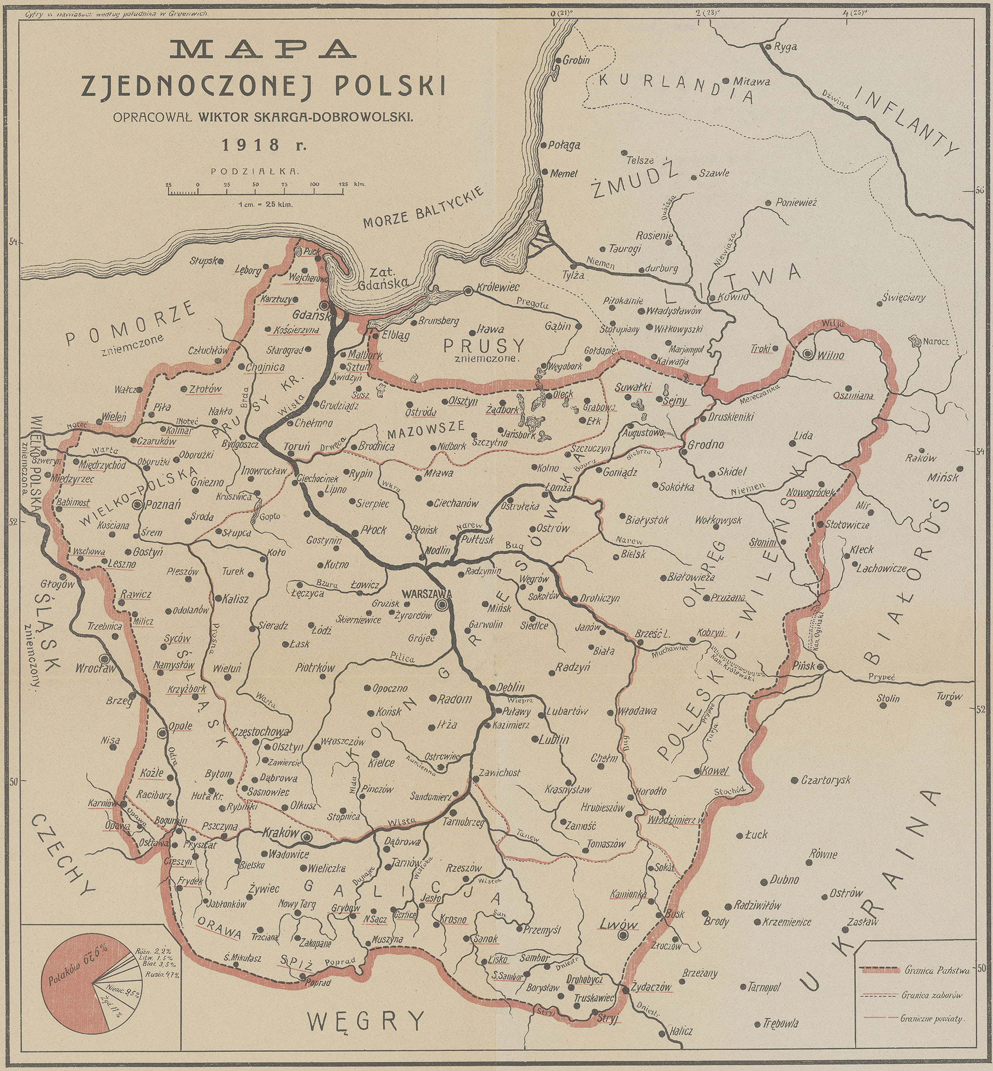
Published in late 1918 by cartographer Wiktor Skarga-Dobrowolski, the iconic map of United Poland emerged at the exact moment the nation regained its independence after 123 years of partition. Carrying the patriotic slogan, "We don't want what belongs to others, we won't give up what is ours!", this document served as both a diplomatic manifesto and a psychological morale booster for a reborn nation. It represents a carefully calculated geopolitical vision that attempted to balance Poland’s historical legacy with its actual ethnic demographics.
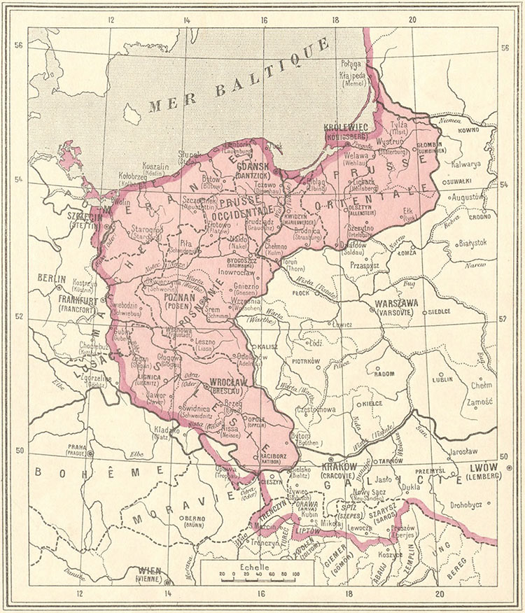
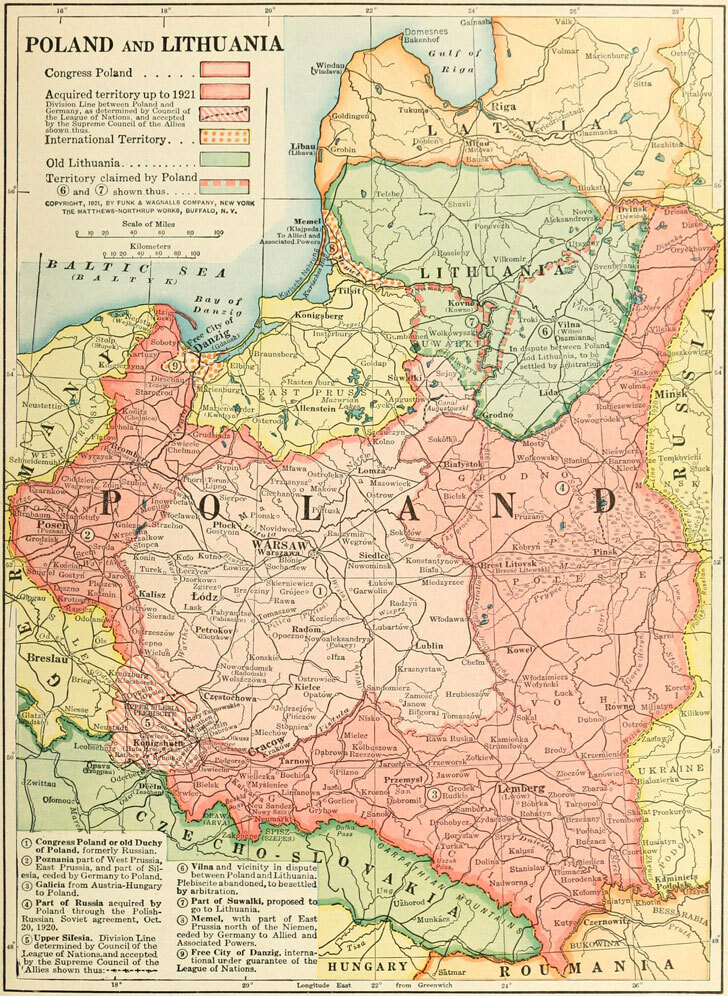
In the west and north, the map takes an uncompromising stance on securing access to the Baltic Sea, claiming the region of Gdańsk Pomerania (Danziger Pommern) and directly incorporating the strategic port city of Gdańsk (Danzig) into Poland, rejecting the compromise that later turned it into a Free City. It also firmly claims the industrial powerhouse of Upper Silesia, parts of East Prussia, and the region of Greater Poland, which were all heavily contested with the German Empire. Along the southern frontier, the map completely integrates the former Austrian province of Galicia, dissolving old imperial lines while pushing aggressively into Cieszyn Silesia, Orawa, and Spisz to capture resource-rich areas that would soon become flashpoints of conflict with Czechoslovakia.
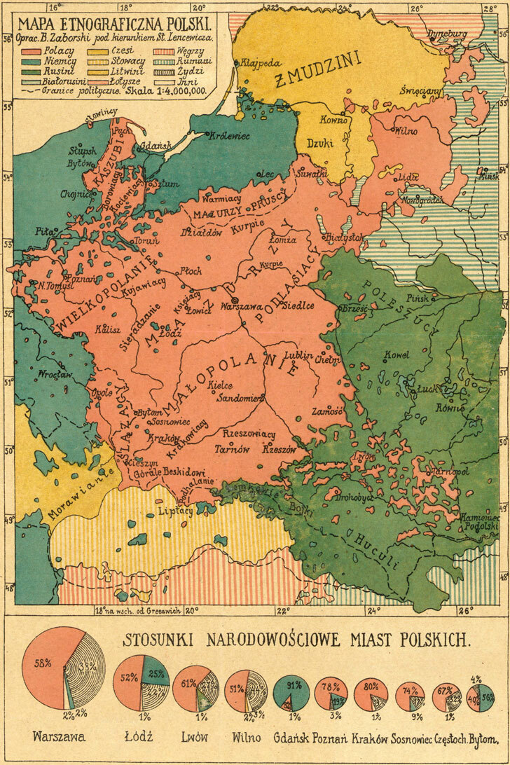
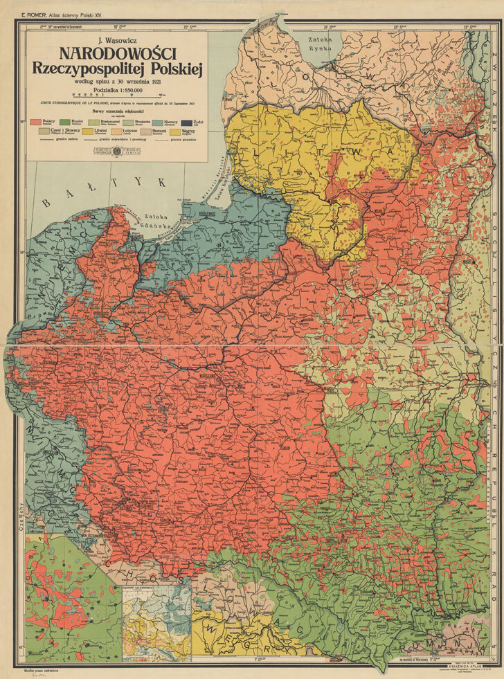
In the east, rather than demanding the vast, historical borders of the pre-partition 1772 Polish-Lithuanian Commonwealth, the map charts a more moderate, realistic path. It swings north to firmly include the major Polish cultural and population centers of Wilno (Vilnius) and Lwów (Lviv), but pulls the line further west to avoid absorbing overwhelming numbers of East Slavic populations in Byelorussia and Ukraine.
What makes Skarga-Dobrowolski’s 1918 layout interesting is its prophetic accuracy. While contemporary politicians were fiercely divided between seeking an impossibly large historical empire or a minimal ethnic state, this map struck a middle ground. Despite being drawn before the regional border wars even began, its lines almost perfectly predicted the official, final borders of the Second Polish Republic eventually consolidated by treaty in 1921. It remains a definitive visual testament to the territorial ambitions, anxieties, and triumphs of modern Poland at its moment of rebirth.